
Camberwell Junction Activity Centre
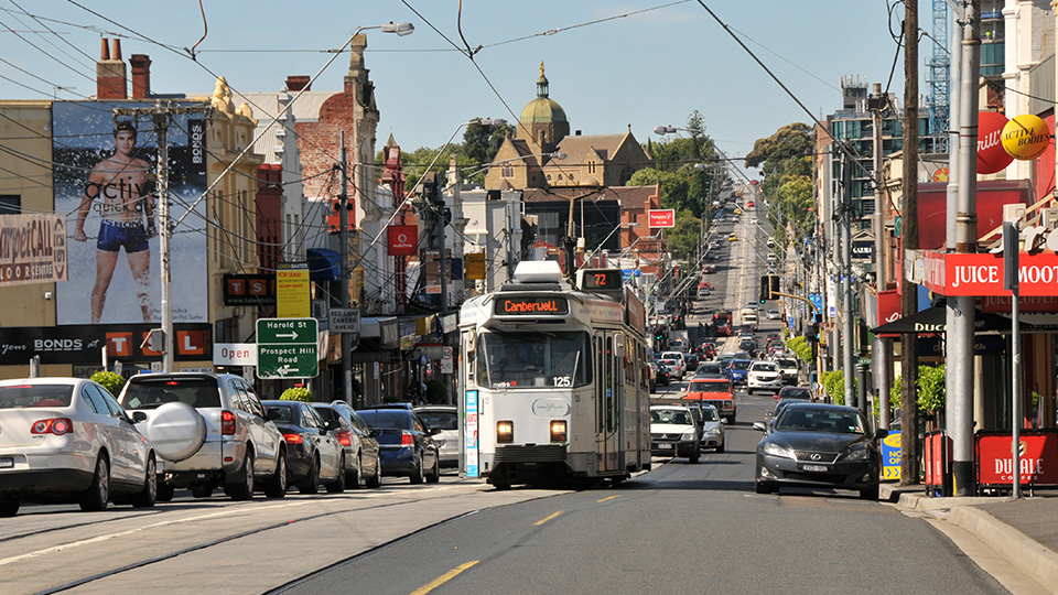
The Camberwell Junction Activity Centre controls were gazetted and came into effect on 11 April 2025.
Camberwell Junction is unique among Boroondara’s Activity Centres because it formed part of the Victorian Government’s Pilot Activity Centre Program.
Unlike the other centres, Camberwell Junction had already been the subject of two years of extensive strategic planning and three stages of community consultation undertaken by Boroondara Council. The resulting Camberwell Junction Structure and Place Plan, prepared and adopted by Boroondara Council, was awaiting the Minister for Planning’s approval for incorporation into the Boroondara Planning Scheme when the Government introduced its own Activity Centre reforms.
While the Government adopted much of Council’s vision for the activity centre core, the surrounding residential catchments for higher-density housing were developed independently by the Victorian Government and did not form part of Council’s Structure and Place Plan or the associated community consultation.
The Camberwell Junction 10-minute Density Zones (walkable catchments)
A large number of surrounding residential streets are now included within catchment areas that allow development of up to 6 storeys.
The Government defines a walkable catchment as the area within an 800m radius (or approximately a 10-minute walk) from a central destination. However, rather than measuring the catchment from the train station or from the Camberwell Junction shopping strip itself, the Government measured it from the outer extremities of the area previously identified by Council.
As a result, the catchment extends substantially further into surrounding residential neighbourhoods and, in some locations, reaches distances closer to a 20 minute walk. This methodology was criticised during the advisory process, including concerns that the 10-minute walkable catchment principle was not being applied consistently.
Important details:
- The addition of 3–6 storey apartments across large residential catchments was not supported by Boroondara Council.
- Approximately 10,800 dwellings are affected, including around 4,500 heritage-protected homes.
- Twenty-six heritage precincts fall within the affected catchment area.
- Public, social and affordable housing targets are not included within the plans.
- No meaningful Council nor community consultation was conducted on the Government’s expanded catchment model.
Community and expert consultation concerns
The Government-appointed Activity Centres Standing Advisory Committee, convened by the Planning Minister to advise on the pilot activity centres including Camberwell Junction, made a number of recommendations that were ultimately not implemented.
Had those recommendations been adopted:
- The residential catchment rezoning would not have occurred.
- The activity centre core would have been substantially smaller and by extension the catchment.
- The 10-minute walkable catchment criteria would have been applied more consistently from Burke Road and the shopping strip itself.
- Heritage precincts would have been excluded from the catchment.
More than 4,000 community responses were reportedly received during consultation. However, BCG understands that none of those submissions was referred directly to the Activity Centres Standing Advisory Committee.
Changes made following consultation were generally limited to relatively minor catchment boundary adjustments. One concession was the removal of some heritage precincts closest to the core from the 4–6 storey zoning areas. However, these areas remained within the catchment and were instead designated for 3–4 storey apartments and townhouse development.
The recommendations of the Activity Centres Standing Advisory Committee can be found in Reports 1, 2 and 4 (View Reports).
Final Plans
The official government map shows the gazetted Camberwell Junction Activity Centre core and catchment boundaries, together with the building heights that now apply within each area.
Camberwell includes a core, an inner catchment and an outer catchment.
Within the core, buildings of between 6 and 12 storeys are permitted.
The core height limits are discretionary, meaning the Planning Minister can approve developments that exceed them.
The inner catchment allows development of up to 4 storeys on most lots and up to 6 storeys on larger lots, while the outer catchment allows development of up to 3 storeys on most lots and up to 4 storeys on larger lots. Larger lots are generally defined as sites of at least 1,000 square metres with a minimum 20-metre frontage.
A substantial area of the catchment covers heritage overlays which can be seen in this map. The heritage overlays will remain in place but the catchment will be rezoned as HCTZ (Housing Choice and Transport Zone) which prioritises housing density and housing diversity. See Heritage at risk.
Map of Core and Inner and Outer Catchments
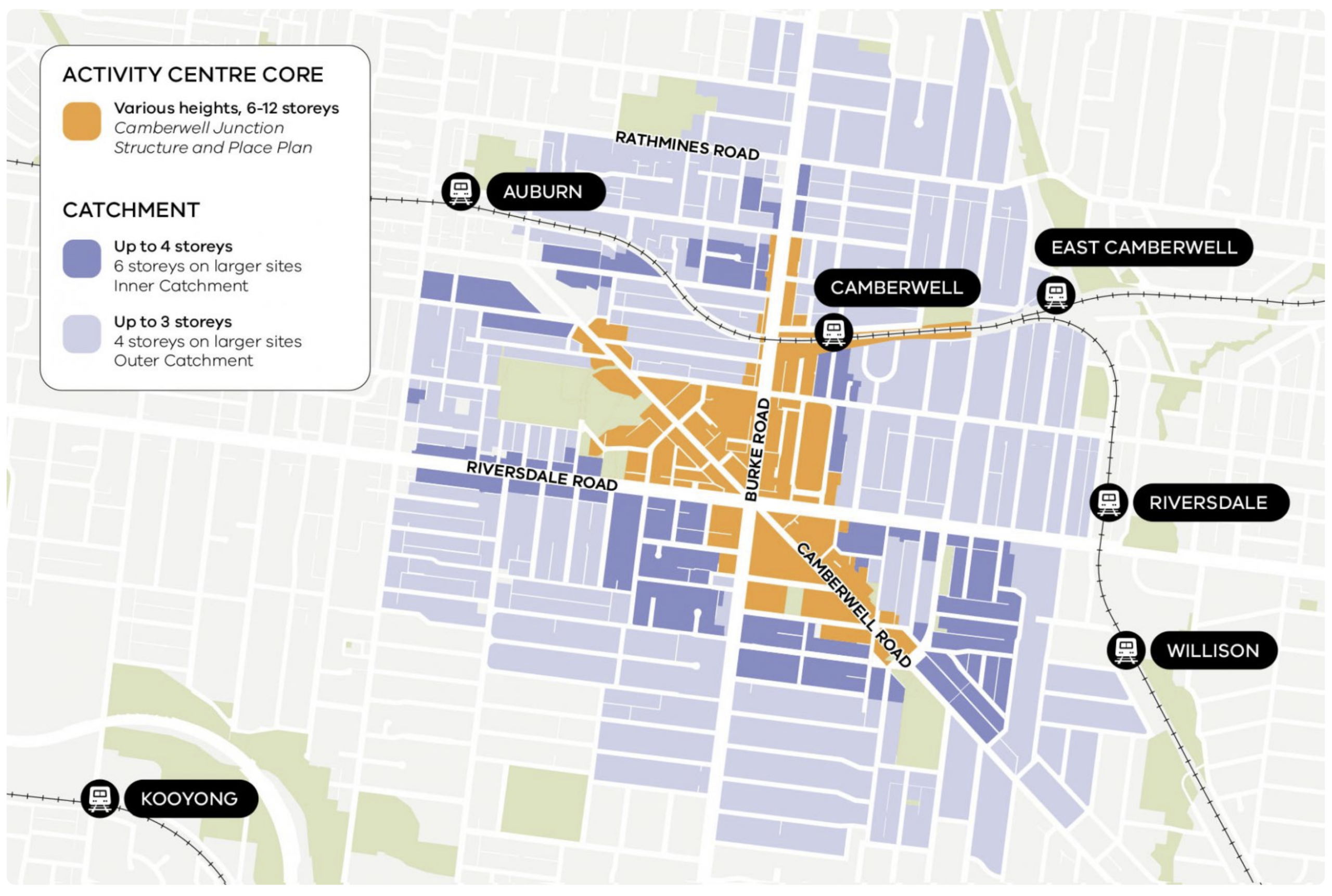
Source: Department of Transport and Planning (DTP), Camberwell Junction Activity Centre Plan (March 2025). (Visit DTP webpage).
The Camberwell Junction Activity Centre Plan is available here.
Looking for more detail? Explore the Government Plans, Concerns, Heritage at risk, Resources → Planning explained and Concerns → Community consultation and engagement sections for further information about how the planning changes work and the issues they raise.