
Kew Junction Activity Centre
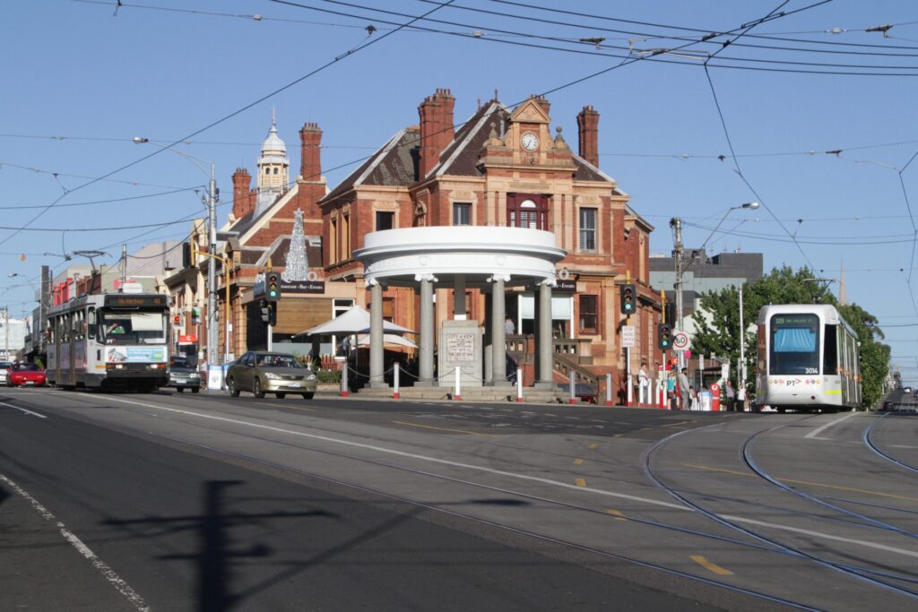
The Kew Junction Activity Centre controls were gazetted and came into effect on 31 March 2026.
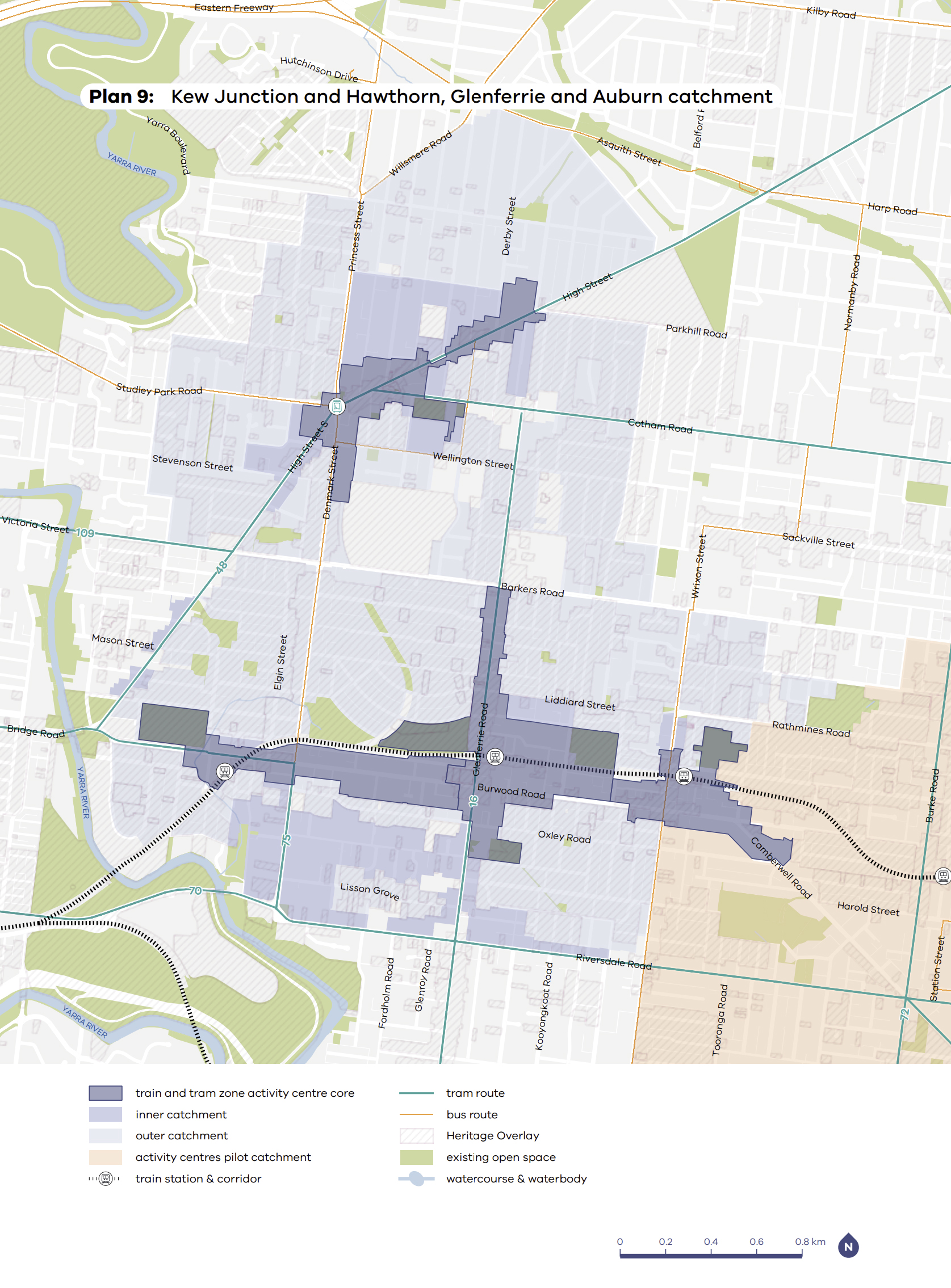
Kew Junction includes a core, an inner catchment and an outer catchment.
Within the core, buildings of between 6 and 16 storeys are permitted.
The core height limits are discretionary, meaning the Planning Minister can approve developments that exceed them.
A current proposal for an 18-storey development on the former Leo’s Supermarket site demonstrates that buildings taller than the published height range may be considered.
The inner catchment allows development of up to 4 storeys on most lots and up to 6 storeys on larger lots, while the outer catchment allows development of up to 3 storeys on most lots and up to 4 storeys on larger lots. Larger lots are generally defined as sites of at least 1,000 square metres with a minimum 20-metre frontage.
The official government maps below show the gazetted Kew Junction Activity Centre core and catchment boundaries, together with the building heights that now apply within each area.
A substantial area of the catchment covers heritage overlays shown in pink hatching on the map. The heritage overlays will remain in place but the catchment will be rezoned as HCTZ (Housing Choice and Transport Zone) which prioritises housing density and housing diversity. See Heritage at risk.
Map of Inner and Outer Catchment
Map of Core
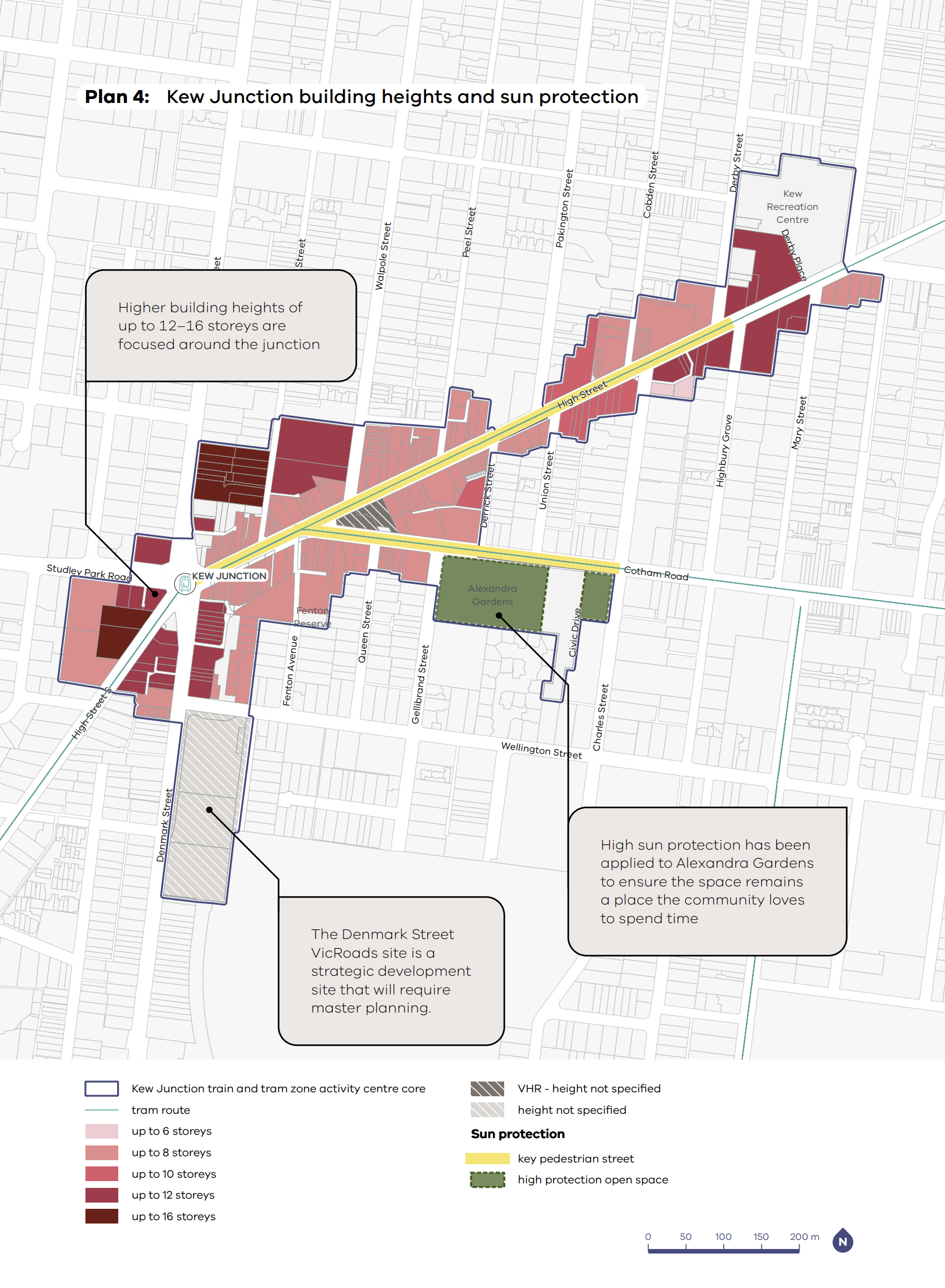
Source: Department of Transport and Planning (DTP), Hawthorn, Glenferrie, Auburn Plan (February 2026). (Visit DTP webpage).
The Kew Junction Train and Tram Zone Activity Centre Plan is available here.
Looking for more detail? Explore the Government Plans, Concerns, Heritage at risk, Resources → Planning explained and Concerns → Community consultation and engagement sections for further information about how the planning changes work and the issues they raise.